Commissioned By
Additional Funding
Collaborators
Methodologies
Forums
Omar Bin Abdul Aziz Hospital, also known as M2, was subject to fourteen strikes by the Syrian military or its allies between June and December 2016, according to the Syrian American Medical Society (SAMS).
The strikes predominantly consisted of air-to-surface missiles, but also illegal cluster munitions, barrel bombs, mines, and artillery. The hospital sustained significant damage over the period, and was rendered out-of-service many times. According to the UN, by mid-August 2016 M2 was one of only three hospitals left in Aleppo that could offer intensive care facilities, and the only hospital with a paediatric department.
Forensic Architecture (FA) collaborated with Bellingcat to
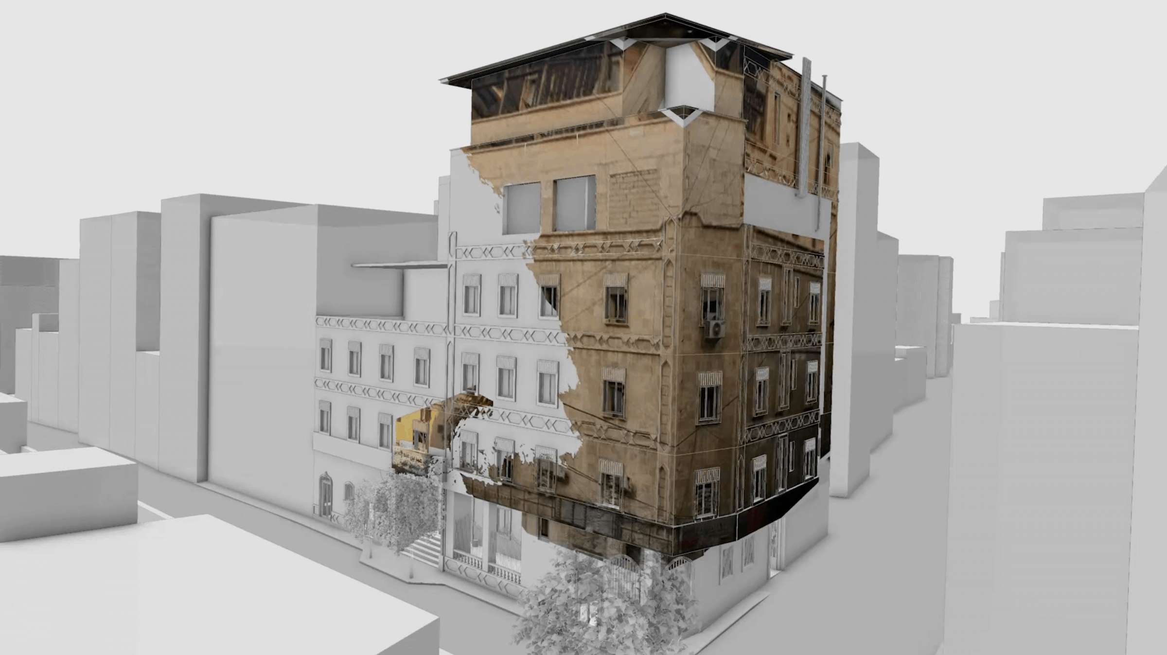
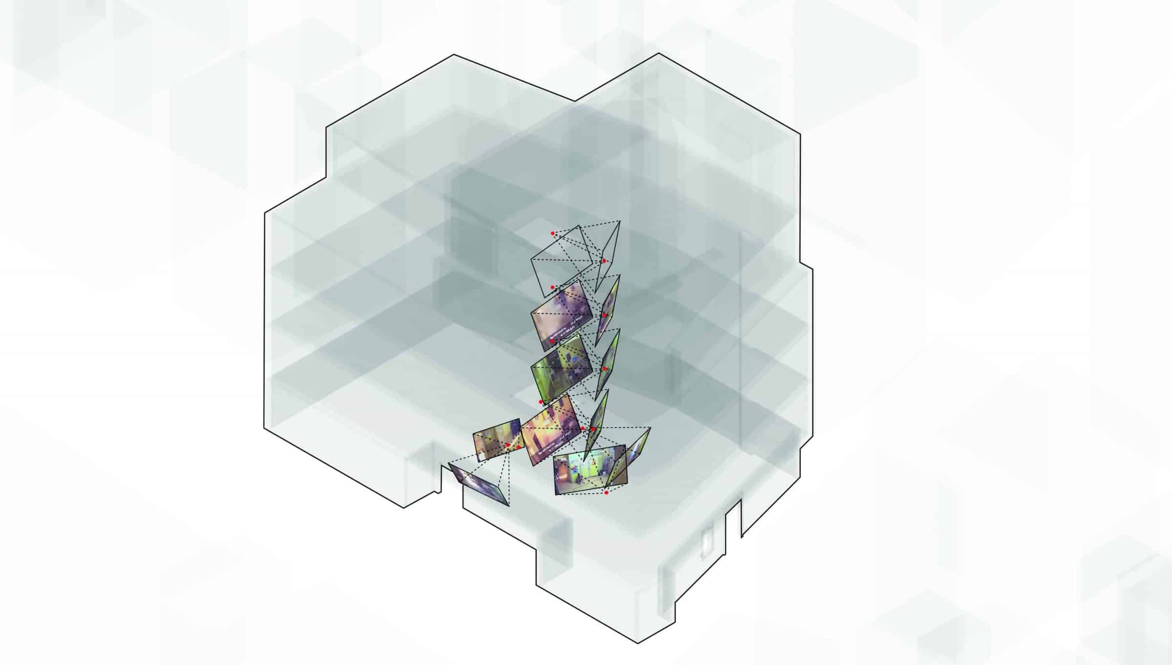
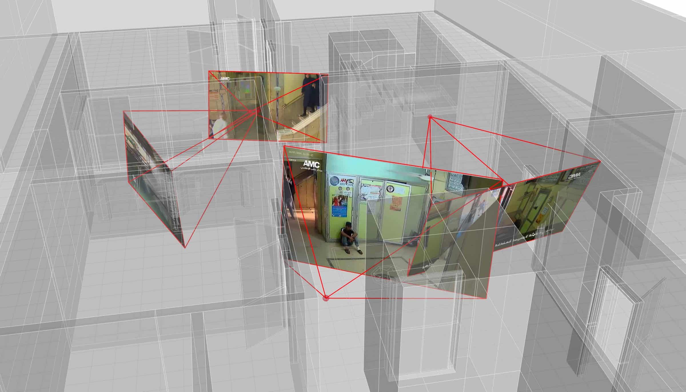
By themselves, individual photographs and videos taken in and around the hospital captured only a small area within the building, but by combining and cross-referencing these clips we were able to reconstruct it in its entirely as a 3D model.
That model allowed us to identify impact sites and resultant damage, and to navigate between various images and videos of the incidents, to produce a cohesive narrative of the building’s destruction.
This narrative supported wider conclusions made in a report by the Atlantic Council about the continued bombing of civilian targets by Syria and its allies. You can view that report at the link above.
SAMS estimates that 2016 was the most dangerous year for health workers in Syria. The group was able to confirm seventy-three separate attacks on medical facilities and personnel in Aleppo between June and December 2016, fourteen of which targeted M2.


Methodology
Methodology
There were a number of CCTV cameras in the hospital that were continuously recording, and which captured every strike. We located each camera in the building in order to integrate their footage as well as footage from handheld cameras, in digital space.
Analysis of one such video captured by a handheld camera shows workers moving from the inside to the outside of the building. This was essential in geolocating the hospital, as it revealed aspects of the neighbourhood environment that could subsequently be identified in satellite imagery. This connection finally anchored the various connected pieces of CCTV footage to a specific building.