In Partnership With
Additional Funding
Methodologies
Forums
Exhibitions
- The Destruction of Yazidi Cultural Heritage at Schafhof – European Center for Art Upper Bavaria
- Phantom Limb at Jameel Art Centre
- Inner Space at the Lisbon Architecture Triennale
- Collective Cities: Seoul Biennale of Architecture and Urbanism
- Maps of Defiance at XXII Triennale di Milano
- Maps of Defiance at London Design Biennale 2018
The Sinjar region of northern Iraq is one of two areas that comprise the heartland of the Yazidis, a religious and cultural minority that has long faced persecution in both Iraq and Syria.
In August 2014, the terrorist group known as ISIL invaded the region. Unprotected by the armies of Iraq or the nearby Kurdish autonomous region, Yazidi villages and towns across the region were captured and razed, and their inhabitants massacred. Thousands of Yazidi women and girls were trafficked into slavery. Religious buildings and sites of Yazidi cultural heritage were specifically sought out and destroyed.
ISIL was driven out of the region in late 2015. But today, many of the Yazidis that escaped still remain in refugee camps in Iraq or Syria, traumatised and reluctant to return.
Forensic Architecture (FA), in collaboration with Yazda, the international representative body for the Yazidi community, set out to train researchers in DIY surveying, mapping and documentation techniques, to support the investigation of the genocide perpetrated by ISIL.
We trained Yazda’s documentation team, based in Dohuk, Iraq, in techniques for evidence-gathering, and in ways of recording the material condition of the ruins of Yazidi buildings, as well as other sites that were part of the violence committed by ISIL against the Yazidi people.
Training was conducted in Turkey, and followed by ongoing fieldwork in northern Iraq, and analysis both in Iraq and at our studio in London.

Further training, documentation, and analysis conducted in this way will create a rich media dataset of sites of violence against Yazidi people and culture, which will in the future be mobilised in support of Yazda’s advocacy efforts, as well as in legal proceedings against known members of ISIL.
Update
 04.09.2018
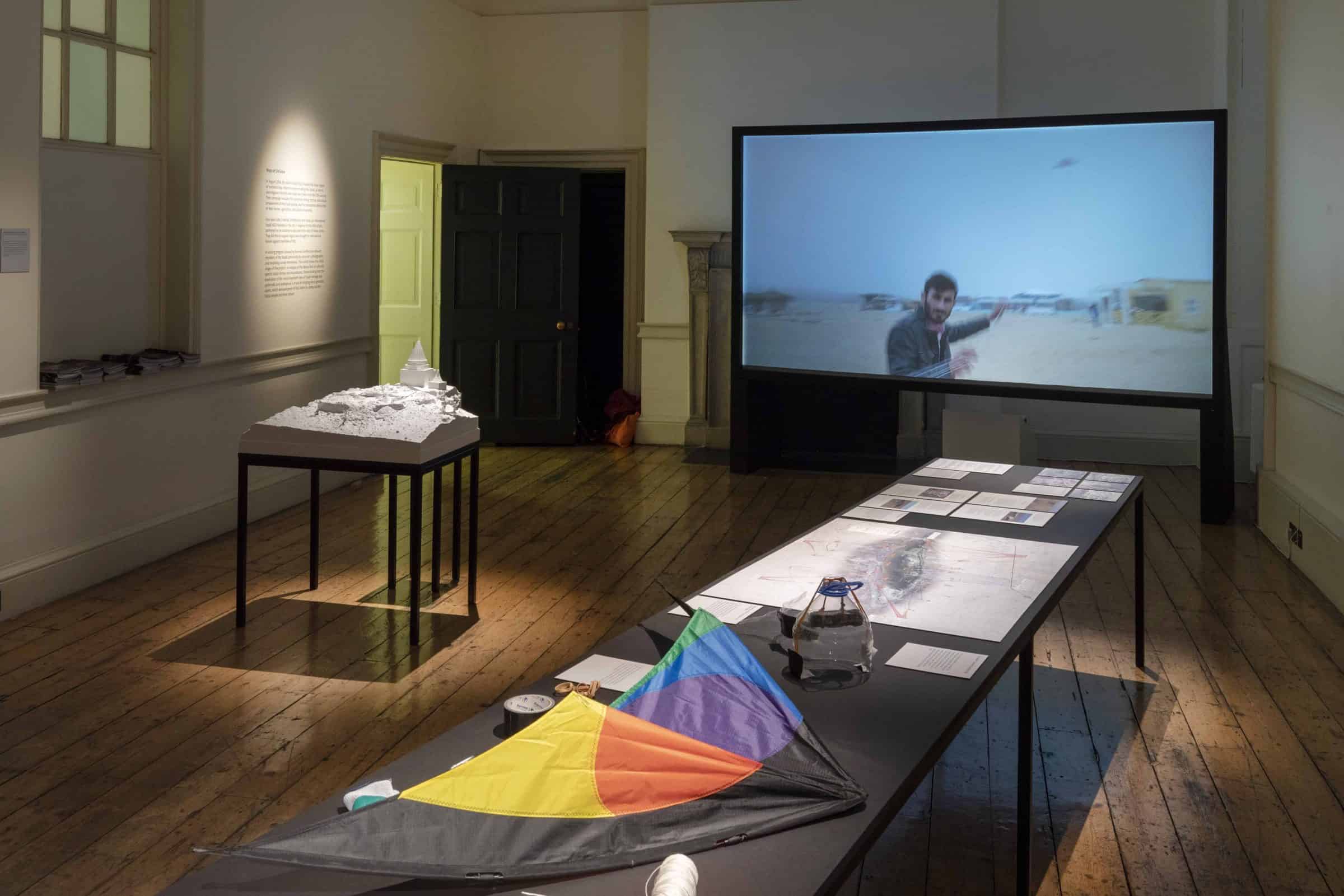
This project, and the results of our first documentation efforts, became an exhibition, ‘Maps of Defiance’, curated by a team from the Victoria & Albert Museum and presented as the UK Pavilion at the London Design Biennale 2018.

Methodology
Methodology
Four years after ISIL’s invasion of Sinjar, mass graves, kill sites, and destroyed Yazidi shrines across the region are still undocumented, their evidentiary value eroding and in danger of being lost. Many such sites are still surrounded by mines and boobytraps left by ISIL.
In order to produce a detailed ‘snapshot’ of their current condition, we developed ways to work accurately, discreetly and safely in difficult conditions.
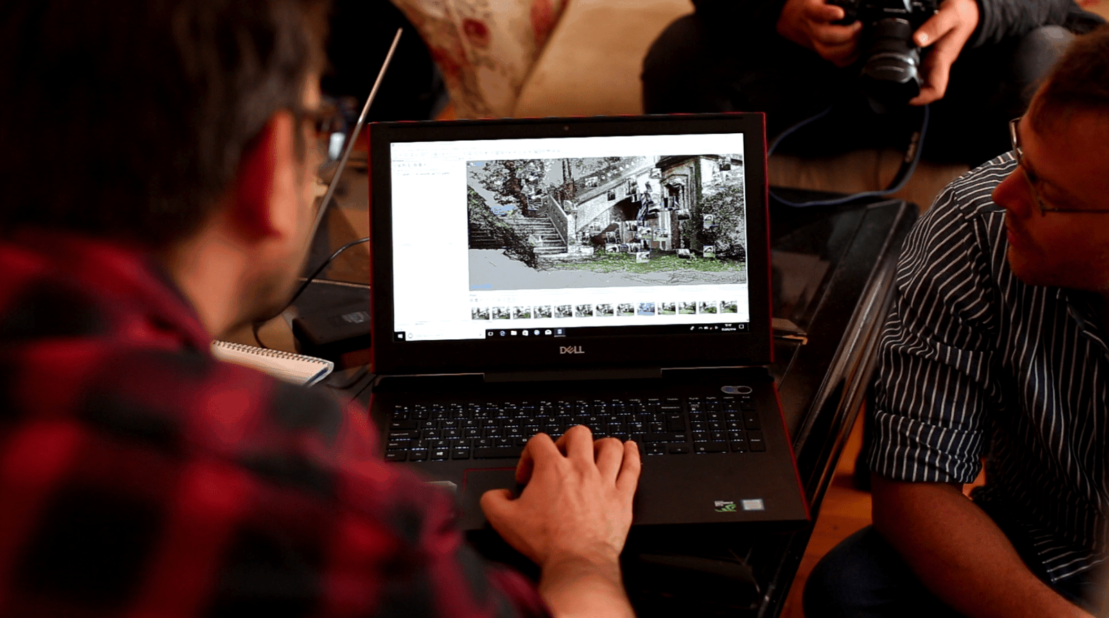
Building on the methodology developed in our study of Bedouin land dispossession in the Naqab, we documented the site through both ground-level and aerial photographs taken by both drones and DIY ‘community satellites’ made from kites. The thousands of images produced from each site are then processed into a 3D point-cloud through a process known as ‘structure from motion’ photogrammetry. Photogrammetry is a computational process by which distance and movement measurements are extracted from a comparison of several still photographs.
Through a process of triangulation, taking into consideration metadata including lens focal length, each photograph is positioned in 3D space, and pixels from the original images are each allocated a place in the 3D environment. The result is a dense ‘cloud’ made of hundreds of millions of discrete points, creating a 3D digital environment from 2D images of the physical space. This point-cloud is geolocated by recording the real-world GPS coordinates of certain points within the images and, therefore, the digital environment.
The DIY aerial photography methods we employed in this project were adopted from previous collaborations with PublicLab. Small point-and-shoot cameras, attached to single-line kites and protected within cases made of plastic bottles create ‘community satellites’ capable of conducting aerial photographic surveys.
While in the air, cameras are set to ‘continuous shooting’ mode, taking several images per second while facing directly down at the ground. We walked the area we wished to photograph from above, pulling the kite and camera with us. The result is an easy-to-use, cheap and reproducible method of aerial photography that can be transformed into a detailed and accurately located model.